The Side Quest: Getting Sidetracked by Tech
I’d like to say I have a perfectly straight-forward roadmap for Ribe 1650, but that would be a lie
Most days, it feels less like a highway and more like a dense forest where I’m constantly distracted by interesting looking trees.
Lately, I’ve wandered off the main path of building the town.
Instead, I’ve been pulled into a "side quest" involving Gaussian Splatting and Drone Waypoint Planning.
I’m not entirely sure where these paths lead yet, but I’ve learned that in a project this big, sometimes the detours are where the most interesting things happen.
The Gaussian Splatting Rabbit Hole
Gaussian Splatting is the current "shiny object" in the 3D world. It’s a bit of a "satisfaction fix", you throw your drone data at it, and it gives you a beautiful, volumetric scene almost instantly.
No tedious retopology, no UV unwrapping, just immediate results.
But as much as I like the speed, I’m still on the fence about it.
Up close, it feels a bit too much like an impressionist painting, a bit "rough" and painterly.
My heart is still set on photorealism, and I’m not yet sure how, or if, I can actually fit these "splats" into a high fidelity game environment.
For now, it’s a fascinating experiment that stays in the "maybe" folder.
Better Tools for Better Data
The other side quest is more practical, but equally deep: I’ve started working on a drone waypoint planner specifically for photogrammetry.
The idea is born out of a bit of frustration. Manual flying is fine, but it’s easy to miss a corner or an angle, leaving "holes" in the data that I have to fix later in the engine.
If I can build a tool that automates the flight path to be perfectly consistent, I get a much better dataset from the start. It’s about building a better hammer before I go back to hitting the nails.
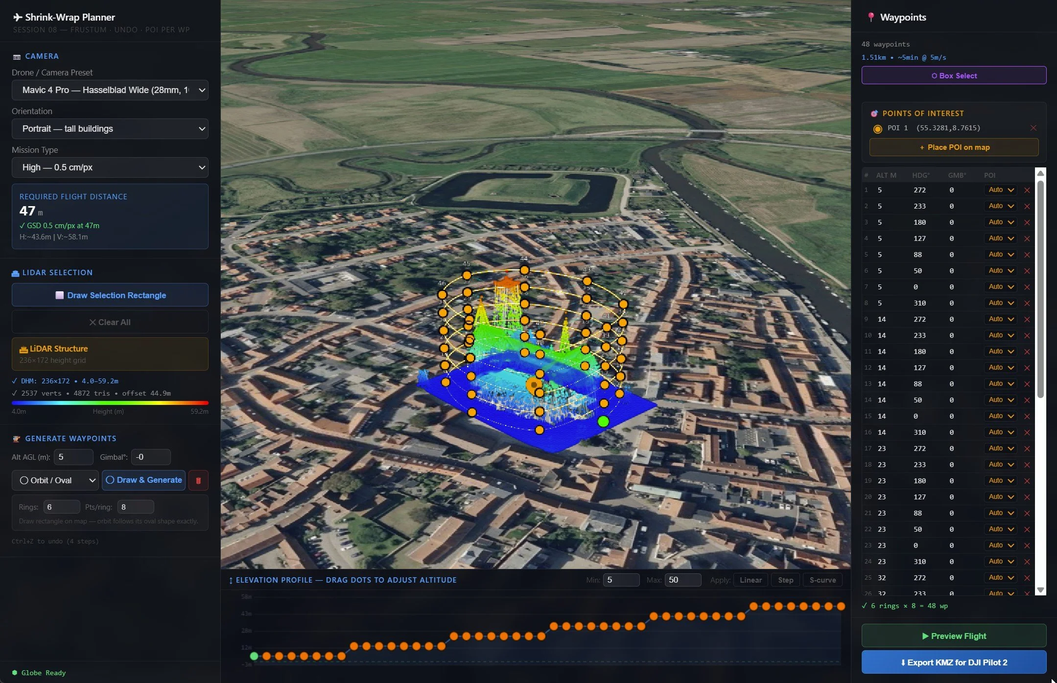
A work-in-progress look at my custom drone planner. By automating orbits and elevation changes, I can ensure 100% coverage of a building's "Architectural DNA" before I even start processing the data.
Just Procrastinating?
It’s easy to feel like this is just procrastination, avoiding the hard work of modeling a hundred houses by playing with new drone software.
But I’m starting to embrace the side quest.
These experiments are how I figure out the best way to handle a project of this scale.
Riberhus will still be there when I get back.
For now, I’m just sharpening the tools and seeing where the tech takes me. :)
This is a Gaussian Splat of a local church created from my recent drone data. While it captures the atmosphere and lighting beautifully, you can see the slightly soft, "impressionist" edges that differ from the sharp photorealism I’m aiming for in the final Unreal Engine reconstruction.
It’s a fascinating look at a different way to represent historical spaces.